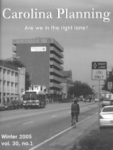
 Volume 30.1 Are we in the right lane? (2005)
Transportation decisions at all levels of planning, from neighborhood to national, concern the efficient and safe movement of goods and people. This issue of Carolina Planning highlights examples of each of these levels of planning, while shedding light on how they are interconnected.
Editors: Helen Chancy, Adena Messinger, Laura Sandt, and Rawley Vaughan
A digital version of this issue is available here.
| LEVEL OF SERVICE MEASURES FOR BIKING: A COMPARATIVE ANALYSIS OF CALCULATION METHODS
Day, Matthew M. Traditional methods for computing level of service (LOS) have implicitly favored mobility at the expense of accessibility. The LOS concept was developed by highway engineers in the 1950s as a method of measuring the level of mobility provided by a certain facility (FDOT, 2002). It has been applied in recent years to alternative transportation modes as walking, bicycling and public transit. This paper analyzes and compares the results of applying several of the LOS methods that have been developed for alternative transportation modes to a study area in Chapel Hill, North Carolina. |
| VALUE PRICING ROADWAYS
Benjamin, Julian Traditional congestion pricing strategies are meant to reduce demand on heavily congested roads by charging every user a toll during times when the facility experiences congestion. Value pricing refers to the practice of requiring drivers to pay the right toll for the first class service of a guaranteed congestion-free lane. This article describes the successful implementation of four such programs launched in California and Texas: State Route-91 in Orange County, CA, I-15 in San Diego, CA, and the I-10 Katy Freeway and US 290 Northwest Freeway in Houston, TX. The article also describes a current ongoing effort to research value pricing projects in North Carolina. |
| A BUSINESS CASE FOR SOUTHEAST HIGH-SPEED RAIL
Chastain, Terry As the Southeastern region of the United States continues to experience increasing levels of congestion on the regional highways, the Southeast High Speed Rail corridor presents an appealing alternative to automobile travel. The corridor is slated to run from Washington, D.C. to Charlotte, North Carolina and eventually from Charlotte to Birmingham, Alabama. The key to implementing the project is the privatization of operations, a model not traditionally used for rail in the U.S. With the Southeastern states moving ahead with the environmental impact statements, the outstanding questing include setting the timeline, choosing the operators, and designing the routes. |
| MASS EVACUATION AND OUR NATION’S HIGHWAYS
Saarthoff, Gregory B.; Noftsinger, John B., Jr. Americans use the interstate highway system as a means of escape from natural disasters, but these roads may offer false hope with regard to escaping manmade disasters. Although the historical record in the United States of such manmade disasters is (fortunately) brief, such disasters—a.k.a. terrorist attacks—require a different and creative approach to prevent chaos and the overuse of the highway system in evacuating metropolitan regions which could potentially lead to other disasters. |
| PLANNER PROFILE: JANET D’IGNAZIO
Carolina Planning Editors This issue’s Planner Profile features Janet D’Ignazio, Senior Research Associate at the Center for Transportation and the Environment (CTE) based at North Carolina State University. Janet has 27 years of experience in the planning field, beginning with her first job after graduate school as the first transportation planner for the Town of Chapel Hill. |